Submit Assignment One: Site Assessment Part 1
Your site sketch will serve as your Base Map, which you will add to in next week's assignments.
Here you will upload your site sketch from Activity 1.1 (Garden or Landscape Area) with added information required from activities 1.3 and 1.4, and your choice of 1.2 or 1.5. Either draw the information from these activities on the map or written neatly on the side. If you chose the wind activity(1.5) you will also upload your completed Wind Chart showing one day of observation.
1.1 Garden or Landscape Area (REQUIRED)- Property sketch (base map)
1.2 Obstructions Above & Below
1.3 Sun & Shade (REQUIRED)
1.4 Hardiness & Microclimates (REQUIRED)
1.5 Wind
Information required for Site Assessment Part 1
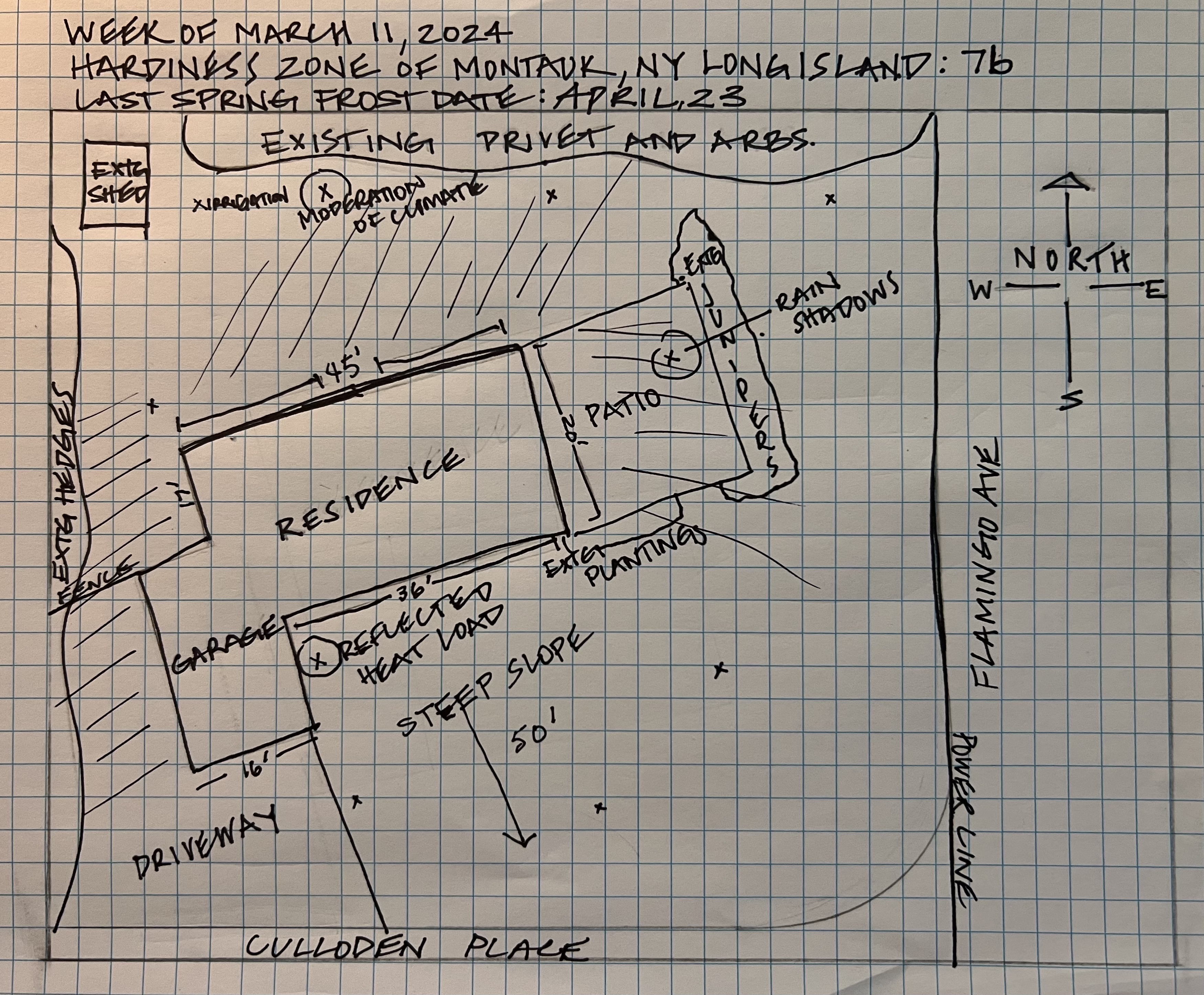
Your Site Sketch (Base Map) should include:
- North Direction Indicated
- Linear Measurements (distances and slopes)
- Area Measurement (square footage/yardage)
- Shade Areas (hatched for three different times)
- Hardiness Zone for Your Site
- Date of Last Spring Frost for Your Site
- Circle Areas of Microclimate (also label type of microclimate)
- Utility Lines Labeled
- Label Wind Flag Sites (indicated by ‘X’ and a Number)
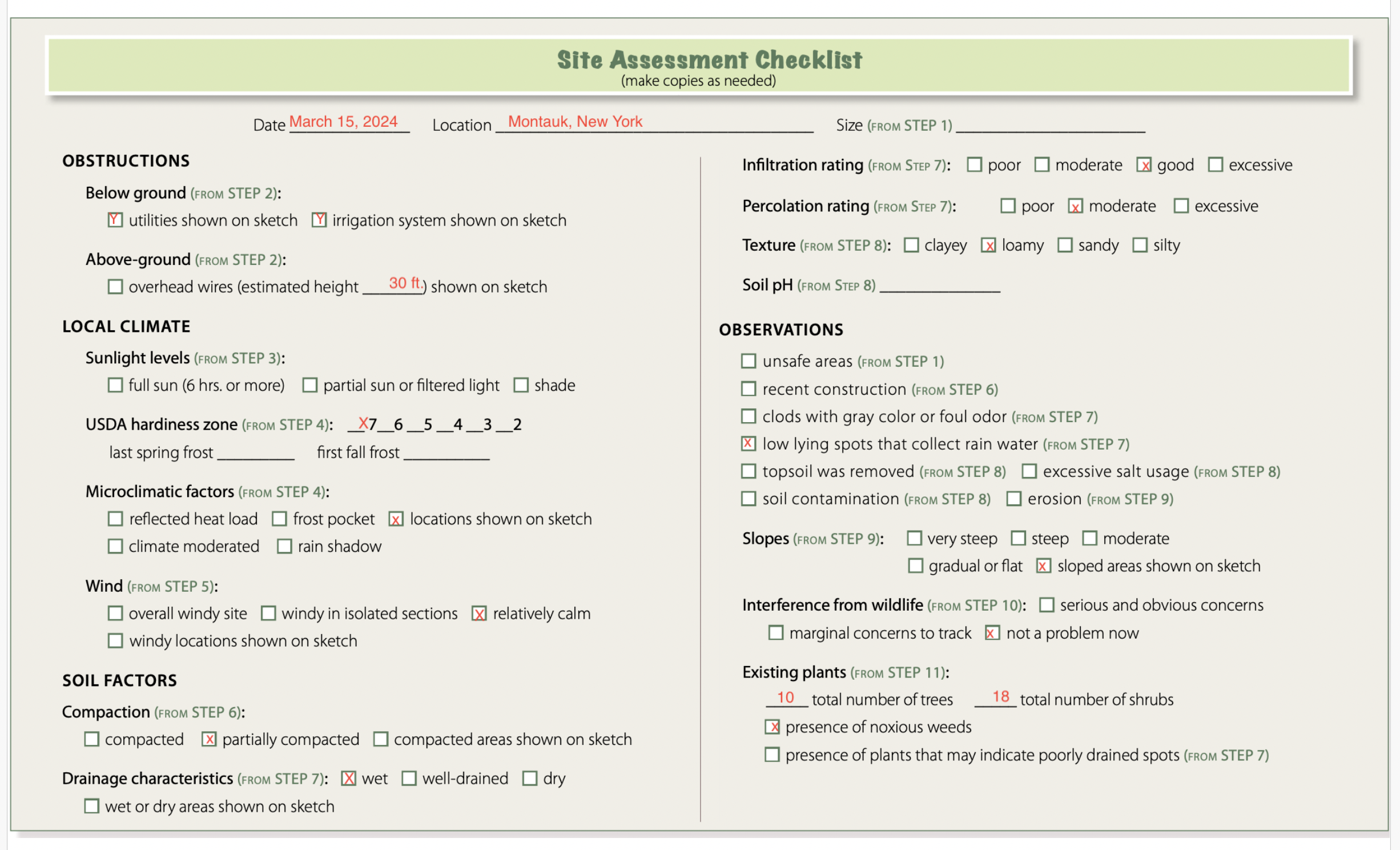
1. On graph paper (you can use this to easily draw to scale):
2. Using tracing paper or drawing directly on a copy of the property plan: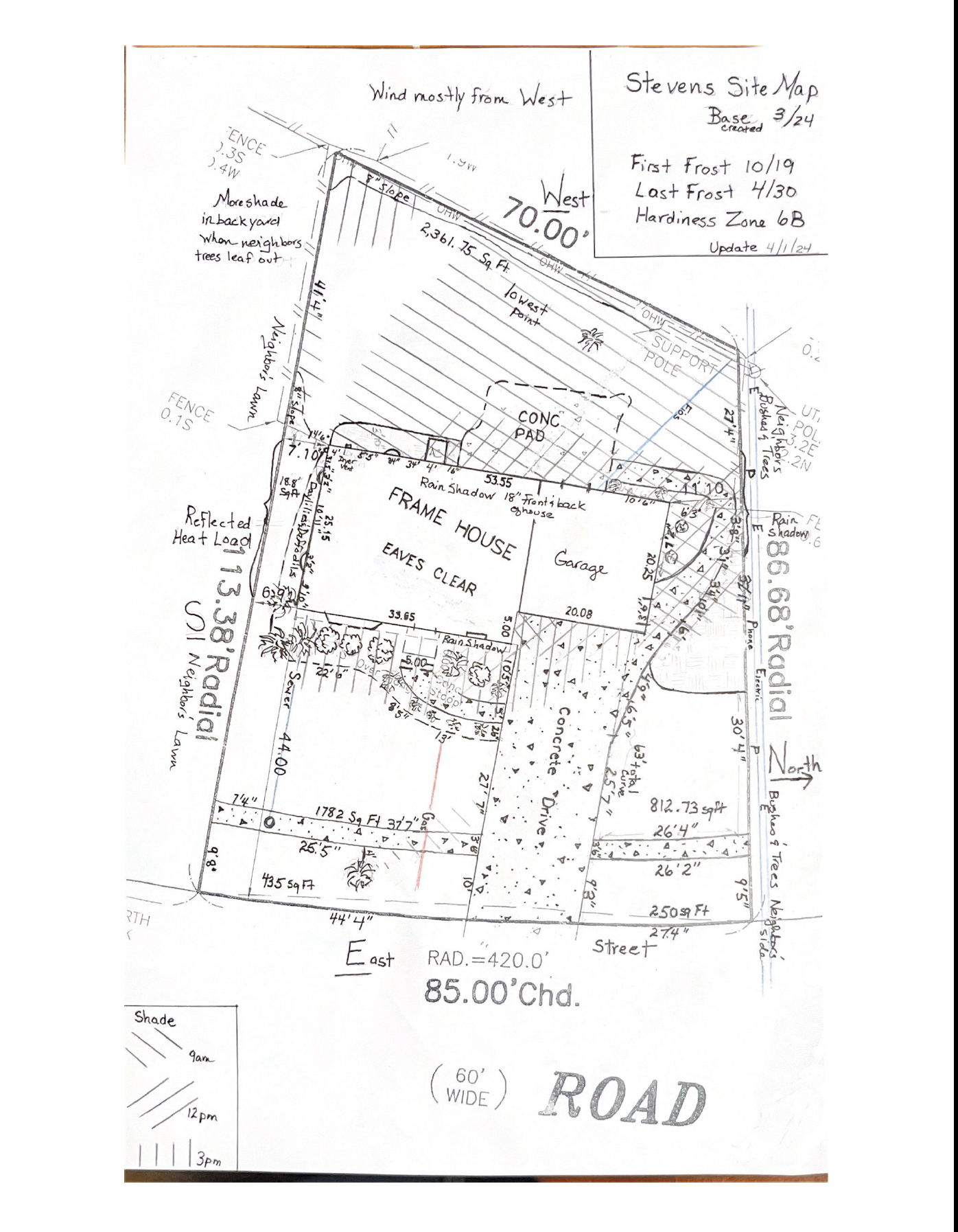
3. Freehand on sketch or drawing paper: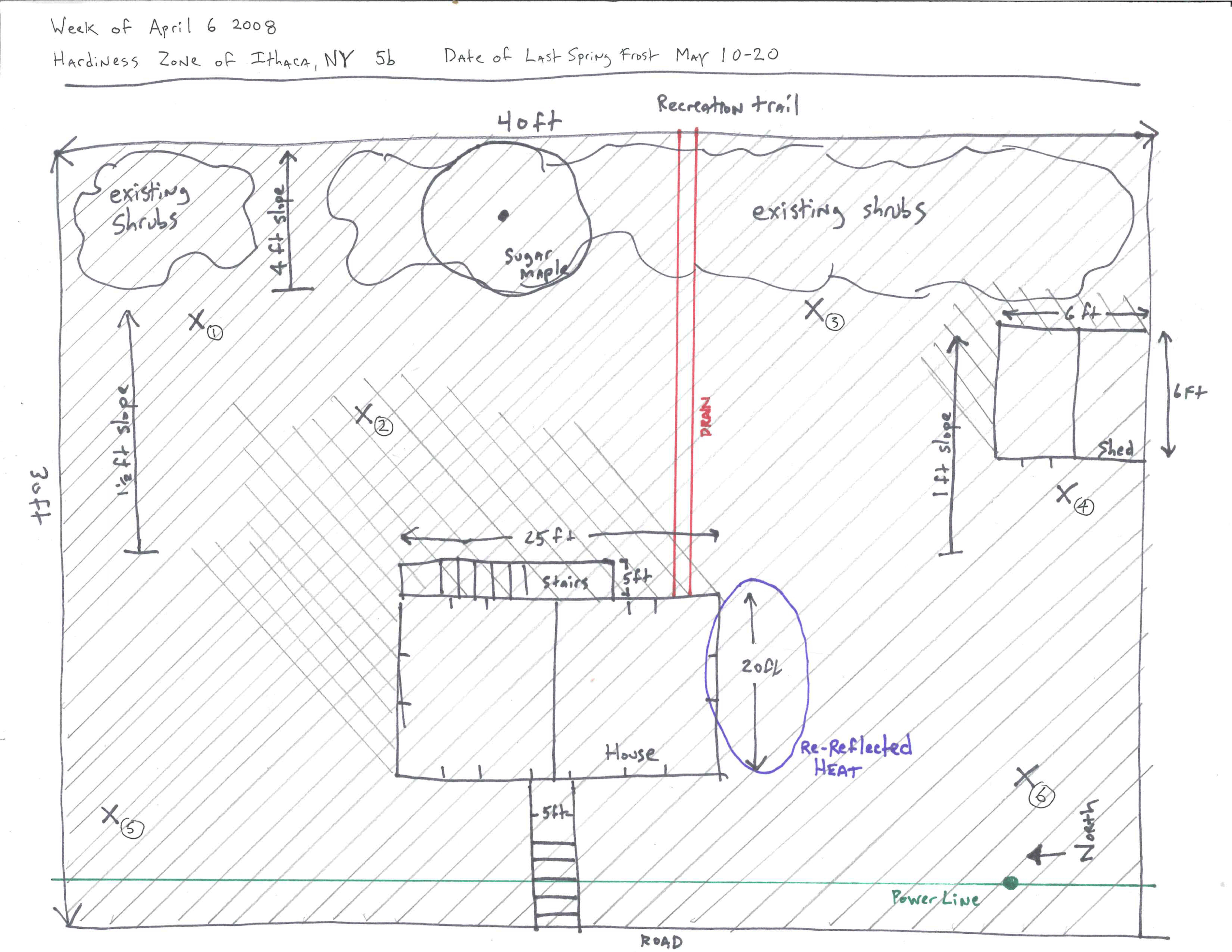
Please be sure to submit your assignment for grading, otherwise it sits in 'draft' form and the instructor does not get notification to grade your work. This tutorial explains the submission process.